August 21, 2017 Experimental Airplane - N727RH
Updated December 18, 2017 |
|
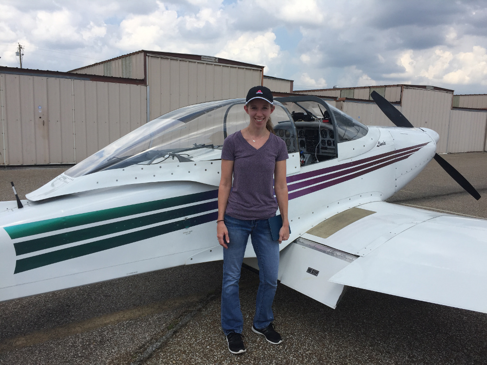 Liz Payne about to board the smallest airplane she's ever been in - for a three-hour flight to see the total eclipse. She had never been in a single engine airplane before. |
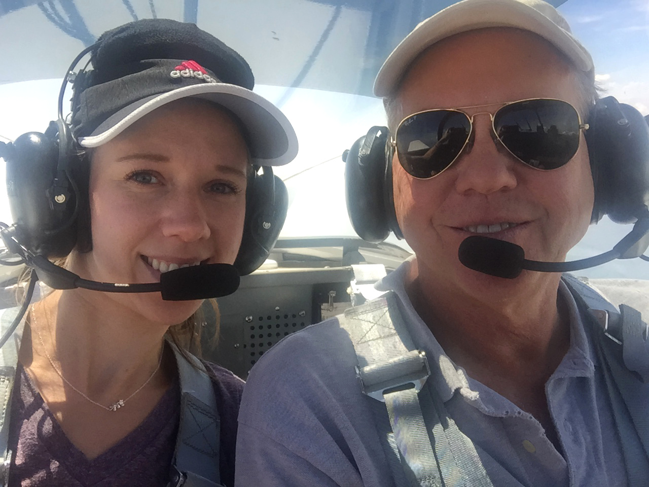 With Liz Payne heading north to Illinois to watch the total eclipse. This was her first flight in the experimental Mustang II. (Three hours long, non-stop!) |
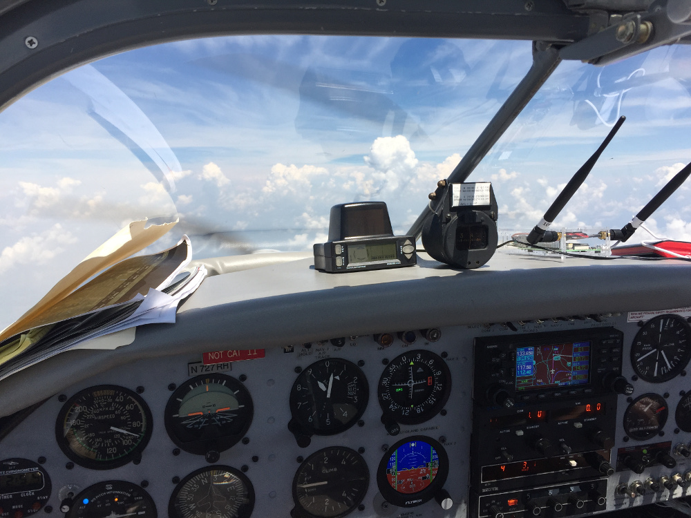 Northbound to the totality area. Yes, I slowed down to try and hit my waypoint "E2" at the start of totality. Tim's ADS-B receiver is on the right side. The portable TCAS is on the left with my folder of printouts and calculations. |
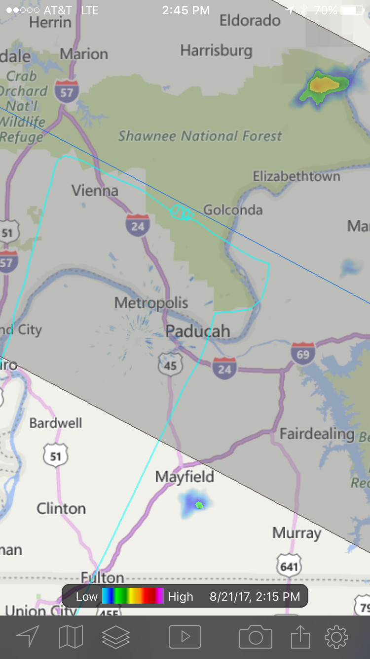
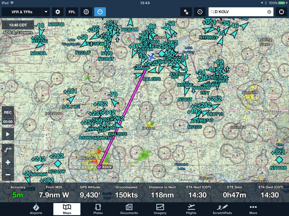 Tim Henry's homemade ADS-B receiver provided the traffic and weather on the iPad. Thanks Tim! |
 Most of these photos were taken by Liz Payne. |
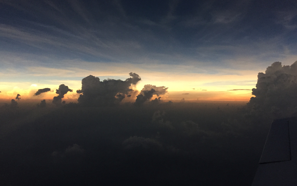
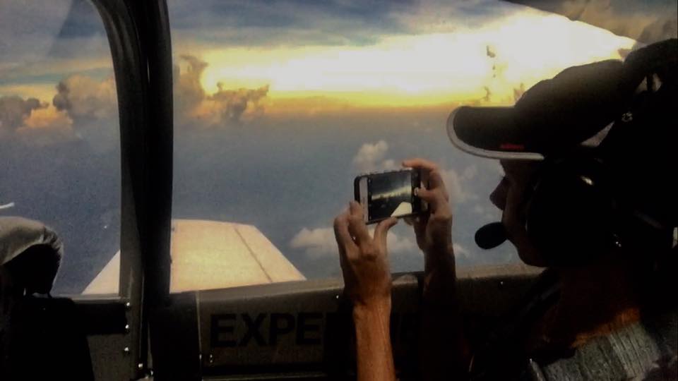
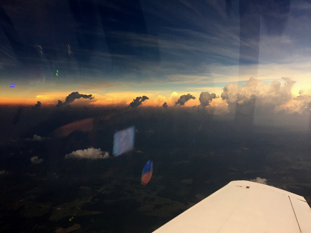 During the totality of the eclipse it looked like this in all directions. "The 360° sunset". Beautiful and amazing. |
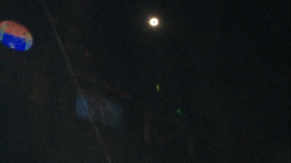 Looking at the sun during the eclipse totality. It was pitch back overhead, but light along the horizon in all directions. I couldn't get the iPhone camera to focus well on the sun's corona. You can see the reflection of some of the plane's instruments on the canopy and get a sense of how dark it was. |
During the totality of the eclipse it looked like this in all directions. "The 360° sunset". Beautiful and amazing. |
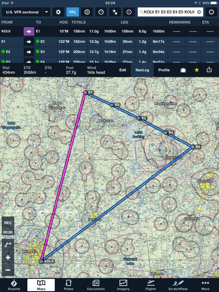 The flight planned route as seen in ForeFlight. Since we wound up doing 360's near "E2", after totality we requested and got a clearance back home just beyond it. |
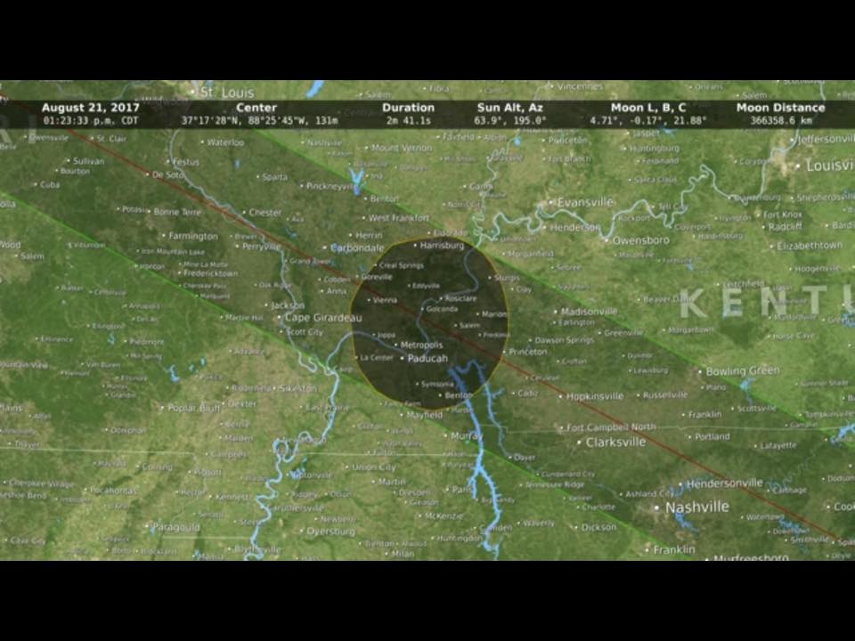 My target spot to view the totality. Timing worked out great (but I slowed down a bit enroute to make my target time). Graphic was from an astronomy magazine. |
 A screen shot from the app "My Radar" showing our route - including the 360° turns in very light aqua. |
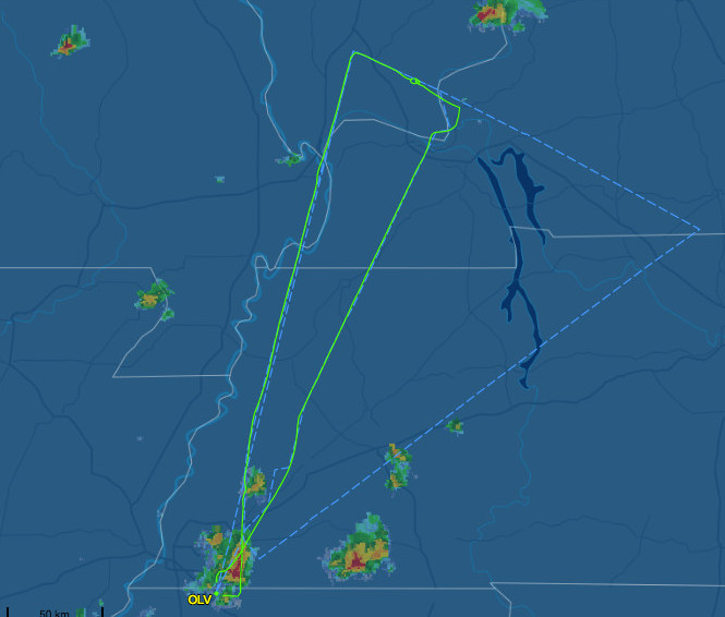 FlightAware track |